To enjoy the beauty of Rome and its surroundings in a gentle and sustainable way, nothing can beat a bike ride
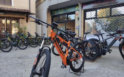
To enjoy the beauty of Rome and its surroundings in a gentle and sustainable way, nothing can beat a bike ride. The capital offers an extensive network of cycle paths - over 390 km - about half of which cross parks and green areas and run along the course of the Tiber and Aniene rivers. For those who do not have their own bicycle, it is possible to rent one at one of the many city Bike Rent points (www.060608.it), choosing between city bikes, mountain bikes and electric bikes with pedal assistance. Bicycles can also be loaded on board the city's public transport, metro buses and trains; for all the information on inter-modality in the capital, visit this page: https://romamobilita.it/it/muoversiaroma/ciclabilita Below are some of the main cycle routes in the capital
Tiberina cycle path
A very attractive and satisfying route which enables you to cross the city transversally, avoiding car traffic. With a length of just over 32 kilometres, it is the longest cycle path in Rome. The altitude gain is minimal and the itinerary, which can be used in all seasons, is suitable for amateur cyclists of all ages.
The track connects Castel Giubileo, in the Agro Romano area north of Rome, with Ponte di Mezzocammino in the south.
Covering wide green areas, it runs almost uninterruptedly along the banks of the Tiber, through the city centre, with here and there historical buildings and bridges.
The itinerary, which can be covered in about two and a half hours, touches important places linked to the history of the city and its river: not only monuments but also an urban nature reserve, protected and managed by the WWF since 1997. This small treasure chest of biodiversity is located along the banks between the Risorgimento Bridge and the Matteotti Bridge, where the dense vegetation is home to many different species of water fowl.
Along the Aniene and the Tiber: cycling from Monte Sacro to EUR
The route, which is flat and of medium length, runs almost entirely on a cycle track which extends for about 22 kilometres.
The route connects the residential area of Monte Sacro, with its characteristic 'garden city' architecture, in the northern part of the city, with the rationalist EUR district, located to the south, along the city's development towards the sea.
The starting point is via Val Trompia, a 10-minute walk from the LIBIA stop of the Metro B1, near the Aniene river, one of the main tributaries of the Tiber, continuing along the course of the larger river heading south.
Along the way, there are many points of interest that can be visited, depending on time and preference. For those who wish to only cover the route on the outward journey, the underground railway Line B can be easily reached - Eur Magliana or Eur Palasport stops.
Regina Ciclarum
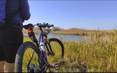
This is a long route, about 60 kilometres, linking Rome with the coast. It starts at Fiumicino, over a combination of cycle paths with unpaved or unprotected stretches, which can be divided into stages and for which mountain bikes are to be preferred.
The starting point is either the Leonardo da Vinci airport or the fishing harbour in the town of Fiumicino, a great place to stop and have lunch or a simple waterfront snack.
The route can be covered independently, but there are many operators who provide bicycle rental and accompaniment services, in and out of the city.
After briefly passing through the town on the cycle path, you will find yourself surrounded by a lush natural environment, along the north bank of the Tiber. Follow the track as far as Ponte Galeria, from where panoramic views and unusual glimpses of the river landscape can be enjoyed.
The route then reaches the Mezzocammino bridge where it again joins up with the Tiberina cycle path, before reaching Castel Giubileo and enabling the best-trained cyclists to cross the entire city by bike.
Those who prefer a shorter trip can return to the starting point by train from the Parco Leonardo stop.
Cycling through history: The Via Appia Antica 'Regina Viarum’
The Via Appia Antica, today a Regional Park, linked Rome to Brindisi, one of the main trading ports of antiquity, and was called the 'Queen of Roads' by the Romans.
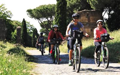
This fundamental artery has preserved its original paving for long stretches and is now an extraordinary historical and nature trail, to be covered on foot or by bicycle, which can be divided into several sections according to individual needs.
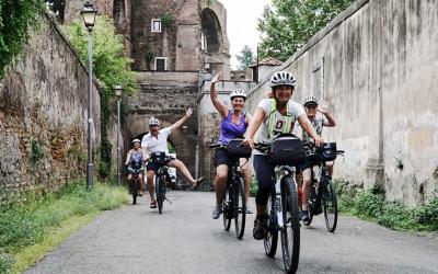
The official starting point of the route is at Largo di Porta Capena, near the Circus Maximus, marked by the presence of two columns, visible in the middle of the road; from here you continue as far as the Aurelian Walls, where there is a small but interesting museum, and then further on past the Catacombs of San Callisto, the Villa of Maxentius and the Mausoleum of Santa Cecilia.
A little further on, near Capo di Bove, is a bike rental point and, if you are tired, you can stop the tour and return to the centre of town by bus (No. 118 or 660).
To also enjoy the out-of-town stretch, you can continue to Frattocchie, a hamlet of Marino, a characteristic town of the Castelli Romani, covering a total distance of 17 kilometres.
Legs permitting, and with a mountain bike to tackle some of the dirt roads, you can continue further to Castel Gandolfo, overlooking Lake Albano, home to the Pope's summer residence.
From here, with a regional train, you can comfortably return to Rome’s Termini station.


